
High-Precision Mapping, Inspections, and Aerial Data for Construction and Agriculture
Our drone-based aerial solutions deliver crystal-clear data to construction managers, inspectors, and agricultural professionals — so you can plan smarter, track your progress, and make decisions with confidence.
33k+
730+
400+
5+
What We Do
Construction & Infrastructure
Track progress, verify subcontractor work, and stay compliant with accurate orthomosaics, 3D site models, and jobsite overviews.
Inspections
Safely inspect rooftops, towers, and hard-to-reach assets with ultra-high-resolution aerial imaging — all without ladders or lift equipment.
Mapping
Capture topographic maps, measure stockpiles, and calculate site volumes with centimeter-level accuracy using drone photogrammetry and LiDAR.
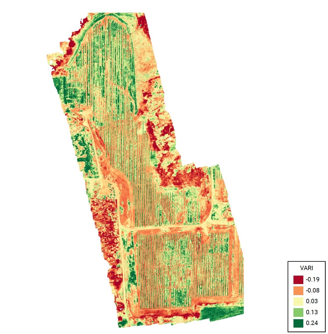
Agriculture
Monitor crop health, track growth cycles, and spot irrigation or pest issues early with NDVI and multispectral mapping — across hundreds of acres in just hours.
Our Process
1. Pre flight planning
We start with a short consultation to understand your site, scope, and goals.
From there, we handle all flight planning, regulatory compliance, and FAA airspace coordination.
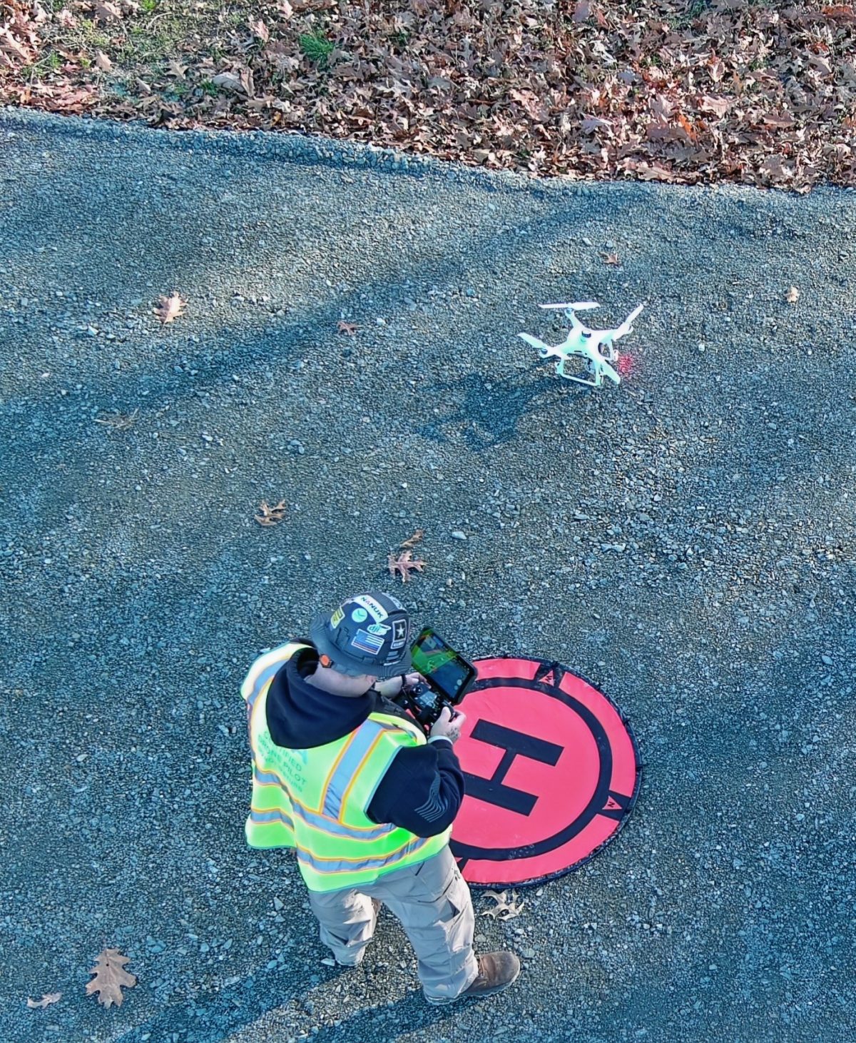
2. Safe, effecient flight ops
Our FAA-certified drone pilots arrive on site prepared to fly safely and efficiently — whether in urban construction zones, remote agricultural fields, or infrastructure-heavy environments.
We follow all safety protocols and local site rules.
3. Data Delivery & insights
High-resolution images, orthomosaics, 3D models, or multispectral maps — your visuals are delivered via secure shared links, formatted and labeled for easy interpretation.
Recurring flights available for long-term monitoring or seasonal projects.
Our Work
Here’s a quick look at the finished products we’re delivering to our clients.


What Our Clients Say
Here are some testimonials of the results we’re delivering to our satisfied clients.

Amanda F. – Power Communications
“SkyeTech gave us accurate maps that helped us spot errors in grading early — saved us thousands.”

Ralph R. – D&C Contracting
“The drone footage made client updates a breeze. Plus, we used the visuals for marketing.”

David M. – Farm Owner
“They mapped 200 acres of farmland in an afternoon. NDVI maps showed us what our eyes couldn’t.”
About Us
Aerial Expertise You Can Trust — With a Friendly, Professional Touch.

Hi, I’m Matt Ricozzi — founder and lead pilot at SkyeTech Aerial.
When you partner with us, you get:
- Ease & Confidence – We handle all flight planning, FAA authorizations, insurance, and compliance so you don’t have to worry.
- Cutting-Edge Tools – We use best-in-class platforms like DroneDeploy, Pix4D, and DJI Terra to capture and process site imagery.
- Actionable Results – From NDVI crop maps and 3D site models to detailed inspections, we deliver visuals that drive smarter decisions.
- Safety & Reliability – We fly to FAA Part 107 standards, are fully insured, and have logged hundreds of flight hours across varied projects.
Whether you’re overseeing a large construction development, monitoring ongoing site progress, managing farmland operations, or performing inspections — we make aerial data simple, seamless, and stress-free.
Ready to take your project to new heights?
Click the button below to request a free quote.

Matt Ricozzi
Founder & Lead Pilot – SkyeTech Aerial
Frequently Asked Questions (FAQs)
Here are some common questions our future clients ask us:
Find Us